Wakayama Prefecture
A Japanese prefecture on the Kii Peninsula with cultural and agricultural prominence.

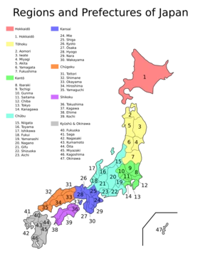
Wakayama Prefecture is a prefecture of Japan located in the Kansai region of Honshu, on the southwestern coast of the Kii Peninsula. It has a population of 876,030 as of 1 February 2025 and a geographic area of 4,724 square kilometres. Wakayama is the capital and largest city. The prefecture borders Osaka Prefecture to the north, and Mie and Nara Prefectures to the northeast. It sits across the Kii Channel from Tokushima Prefecture on Shikoku. Present-day Wakayama is mostly the western part of the province of Kii.
- population
- 876,030 (as of 1 February 2025)
- area
- 4,724 square kilometres (1,824 sq mi)
- capital
- Wakayama
- region
- Kansai, Honshu, Japan
- known_for
- Leading producer of oranges and Chinese flowering plum (ume) in Japan
Verified Timeline
Lore & Background
Present-day Wakayama is mostly the western part of the province of Kii. On July 17–18, 1953, a torrential heavy rain occurred, followed by collapse of levees, river flooding and landslides in a wide area. Many bridges and houses were destroyed. According to an officially confirmed report by the Government of Japan, 1,015 people died, with 5,709 injured and 7,115 houses lost. As of 31 March 2020, 13 percent of the total land area of the prefecture was designated as Natural Parks, namely the Setonaikai and Yoshino-Kumano National Parks; Kongō-Ikoma-Kisen and Kōya-Ryūjin Quasi-National Parks; and several Prefectural Natural Parks including Enju Kaigan, Hatenashi Sanmyaku, Hikigawa, Jōgamori Hokodai, Kōyasanchō Ishimichi-Tamagawakyō, Kozagawa, Nishiarida, Oishi Kōgen, Ōtōsan, Ryūmonzan, Shiramisan-Wadagawakyō, and Shirasaki Kaigan.
Reader's Guide
Mount Kōya in the Ito District is the headquarters of the Shingon sect of Japanese Buddhism. It is home to one of the first Japanese style Buddhist temples in Japan and remains a pilgrimage site and an increasingly popular tourist destination as people flock to see its ancient temples set amidst the towering cedar trees at the top of the mountain. The Sacred sites and pilgrimage routes in the Kii Mountain Range extend for miles throughout the prefecture and together have been recognized as Japan's 11th UNESCO World Heritage Site. The Kumano Shrines are on the southern tip of the prefecture. Wakayama Prefecture ranks first in the production of oranges in Japan. Wakayama has its own brand of oranges, which is produced in Arida District and called 'Arida-Orange'. Arida District, where oranges have been produced for more than 400 years, yields about half of the orange crops in Wakayama today. Furthermore, the yield of Arida-Oranges accounts for about 10 percent of Japanese domestic production of oranges. According to the survey by the Ministry of Agriculture, Forestry and Fisheries of Japan, Wakayama stands first in the production of Chinese flowering plum, or ume in Japanese, in Japan. As of 2016, Wakayama made up about 70 percent of Japanese domestic production of ume. Since 1996, population of Wakayama Prefecture has kept declining, and since 2010, it has been the only prefecture in Kansai region with population below 1,000,000. In the 2020 census, close to 32% of the population was over 65 years of age - the highest percentage in Japan. Wakayama Prefecture has friendship and sister relationships with six places outside Japan: Florida (United States), Galicia (Spain), Pyrénées-Orientales (France), Shandong (People's Republic of China), Sichuan (People's Republic of China), and Sinaloa (Mexico).
Did You Know?
- Wakayama Prefecture ranks first in Japan for orange production, with the Arida-Orange brand accounting for about 10 percent of domestic orange output.
- As of 2016, Wakayama made up about 70 percent of Japanese domestic production of Chinese flowering plum (ume).
- In the 2020 census, close to 32% of Wakayama's population was over 65 years of age — the highest percentage in Japan.
- The 1953 flood disaster in Wakayama resulted in 1,015 deaths, 5,709 injured, and 7,115 houses lost.
- Mount Kōya in Wakayama is the headquarters of the Shingon sect of Japanese Buddhism and is part of a UNESCO World Heritage Site.
Frequently Asked Questions
Who is Wakayama Prefecture?
Wakayama is a Kansai-region prefecture perched on the southwestern edge of the Kii Peninsula, with the city of Wakayama serving as its administrative seat. As of early 2025, roughly 876,000 residents call its 4,724 square kilometres of mountain and coastline home.
What are Wakayama Prefecture's signature abilities?
It leads nationwide production of both oranges and ume (Chinese flowering plum), making it the go-to source for those fruits across Japan. It also anchors the Shingon Buddhist tradition through Mount Kōya, the sect's spiritual headquarters.
Where on the map does Wakayama Prefecture sit?
It occupies the southwestern tip of Honshu's Kii Peninsula in the Kansai region, bordered by the Pacific coast to the south. Its territory spans roughly 1,824 square miles of rugged, forested, and coastal land.
How does Wakayama Prefecture's current chapter play out?
As of 1 February 2025 the prefecture remains an active administrative unit with a population of 876,030, continuing to serve as a hub for pilgrimage, citrus agriculture, and coastal culture. There is no narrative 'ending'—it is an ongoing, living jurisdiction.
Why is Wakayama Prefecture a fan favourite?
It carries a UNESCO World Heritage designation for the sacred sites and pilgrimage routes threading through the Kii Mountain Range, a distinction few Japanese prefectures can claim. Paired with its status as Japan's top orange and ume producer, it packs both spiritual gravitas and agricultural clout into one compact region.
More in Japanese Prefectures 1-24
Elsewhere in the Japanese Prefectures universe
Spotted an error? Know more?
This is a living reference — every entry is fact-audited, and reader corrections feed straight into our audit queue. Suggest an edit · See this site's audit record